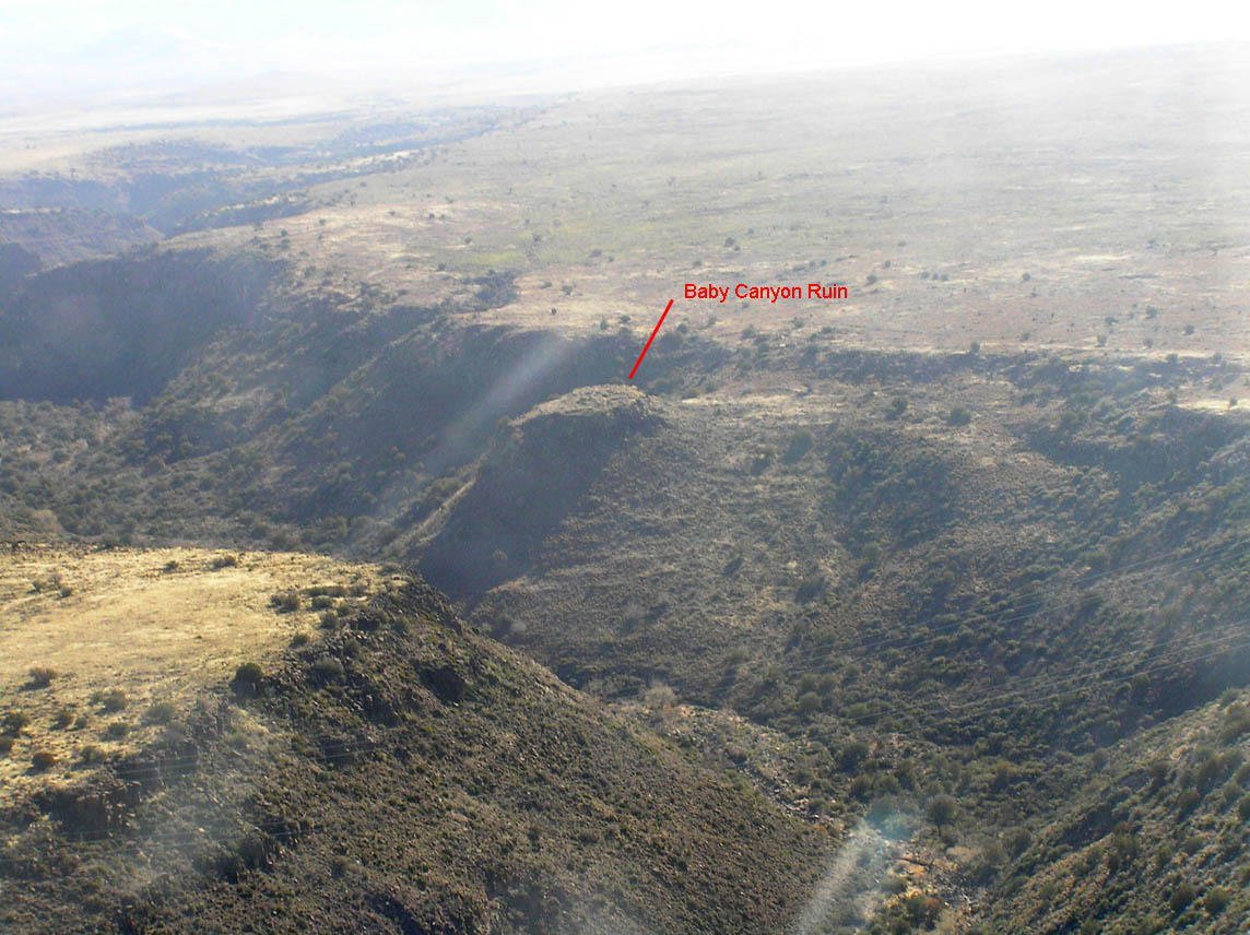
Aerial Photo of Baby Canyon Pueblo--Jan 2011 (click for full-size image)
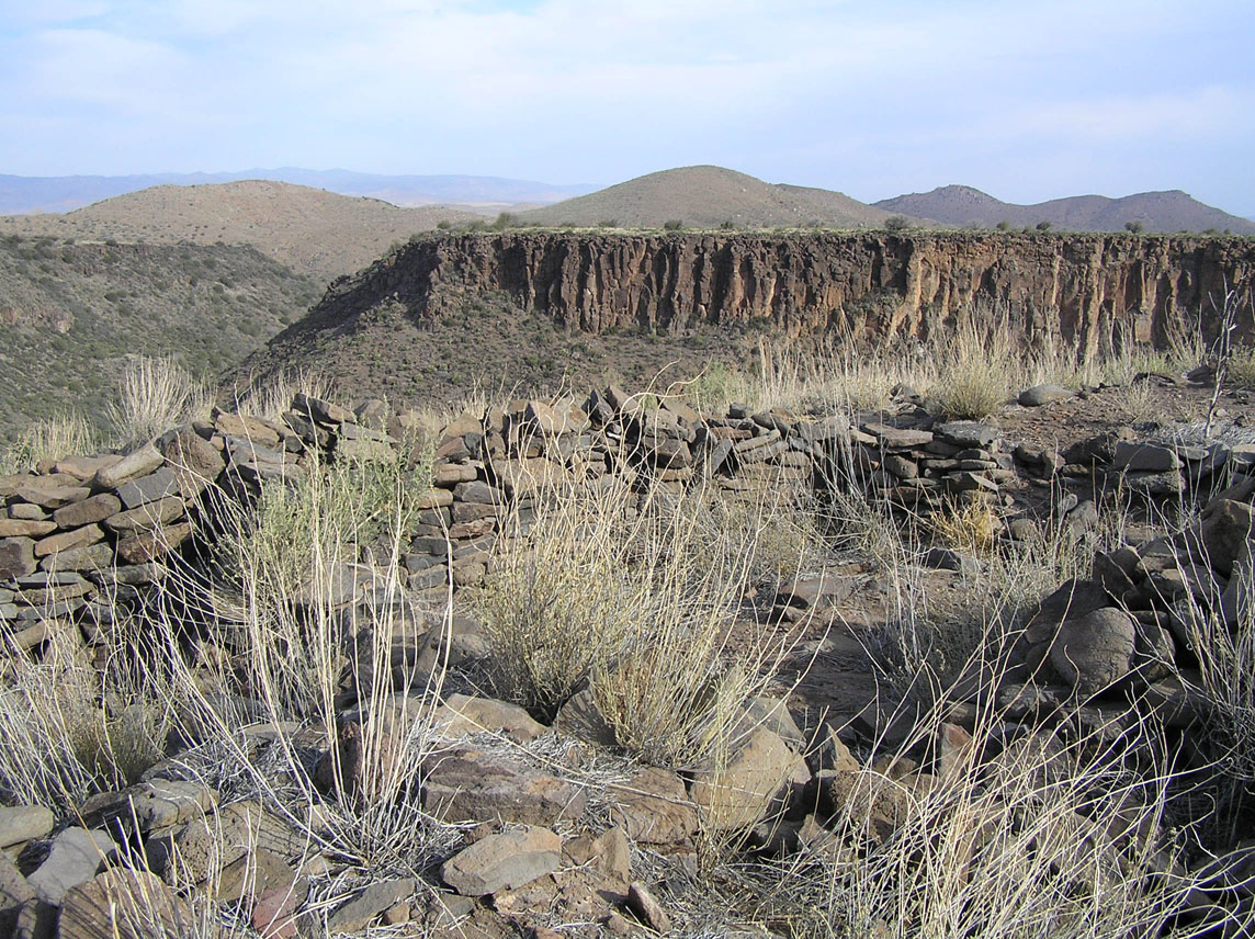
The Baby Canyon ruin is fairly remote, and is therefore slightly better preserved than some of the other sites in the Agua Fria National Monument. Located on top of a hill that rises up out of a deep and rugged canyon, the main ruin has sweeping, dramatic views in three directions. There are a number of smaller sites, petroglyph panels, and agricultural features nearby. If one looks closely at the title photo above, one can see the remains of agricultural terraces covering the slope below the pueblo.
Jun 2007
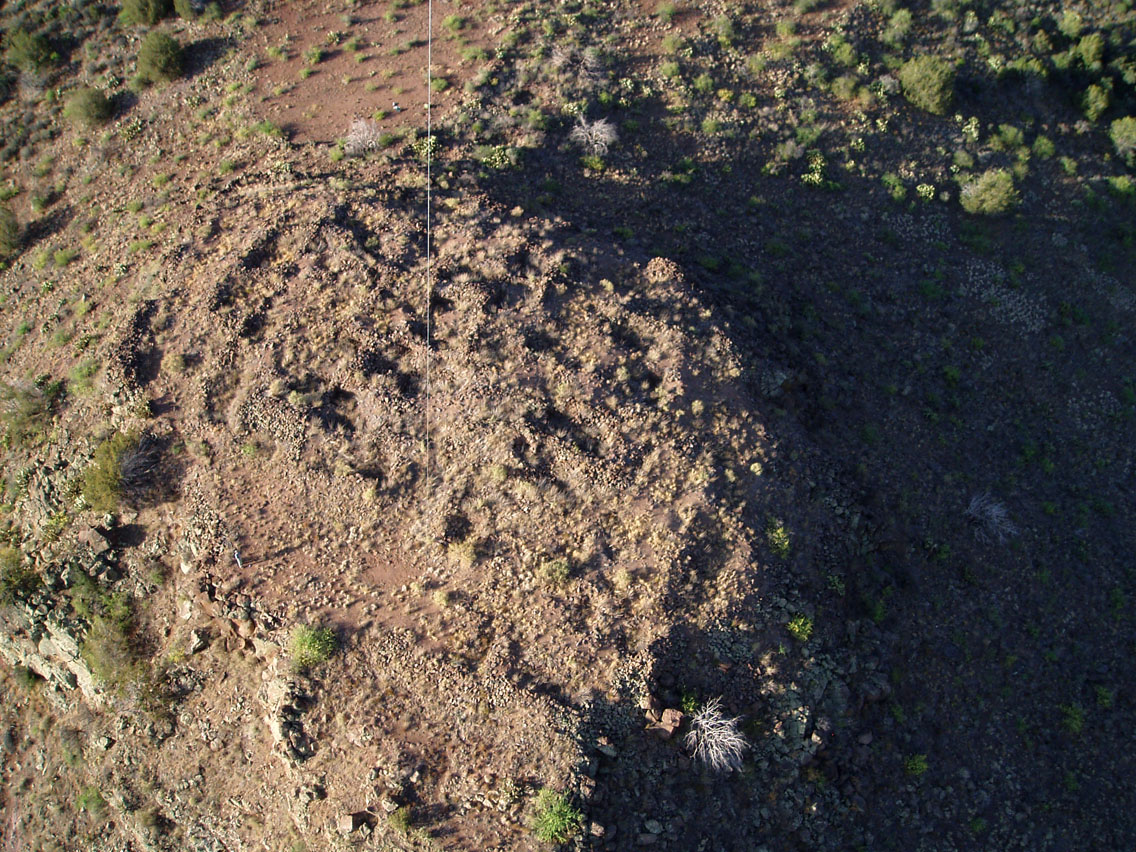
1. High-altitude Balloon-Cam shot.
Jun 2007
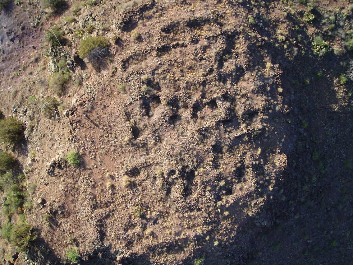
2. Medium altitude Balloon-Cam shot.
Jun 2007
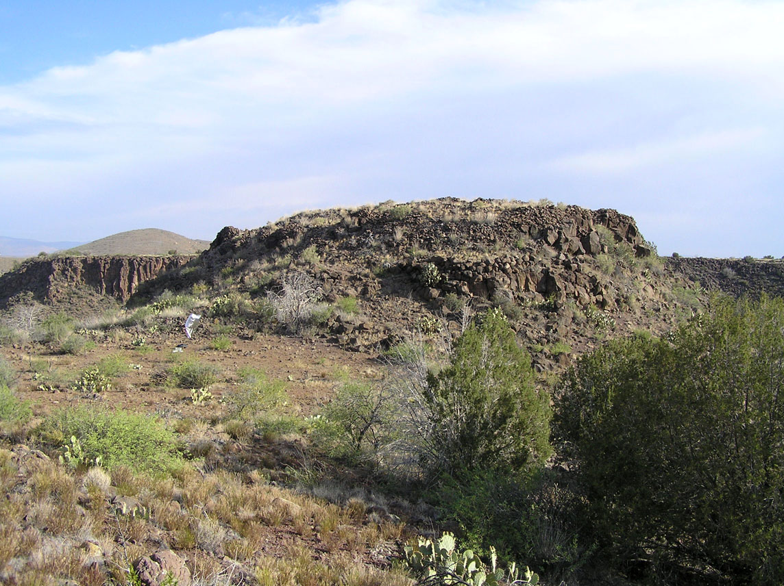
3. Approach to the ruin. The other three sides drop steeply into the canyon.
Jun 2007
4. View from inside the ruin.
As with virtually all sites in the Agua Fria National Monument, the Baby Canyon ruin is difficult to photograph from the ground. Photos 1 and 2 are aerial shots, taken using the Balloon Cam, that give a sense of the scale of the ruin. The white line in the photos is the kite string that tethers the balloon. These photos must be taken early in the morning, to avoid the strong winds that are almost always present on Perry Mesa during the day.
The natural stone used in the construction and the brush that has grown up over the site make the ruin difficult to spot from a distance. Photo 3 shows the saddle that connects the hill to the south rim of the canyon. The other three sides comprise steep cliffs, plunging a hundred feet or more into the canyon below. Photo 4 shows the view from inside the ruin, looking down the canyon.
Jun 2007
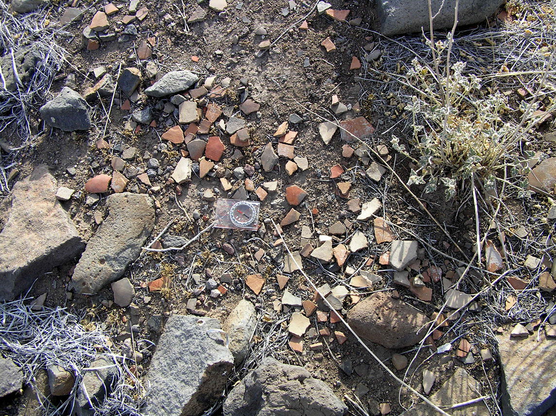
5. Broken matate, surrounded by pot sherds.
Jun 2007
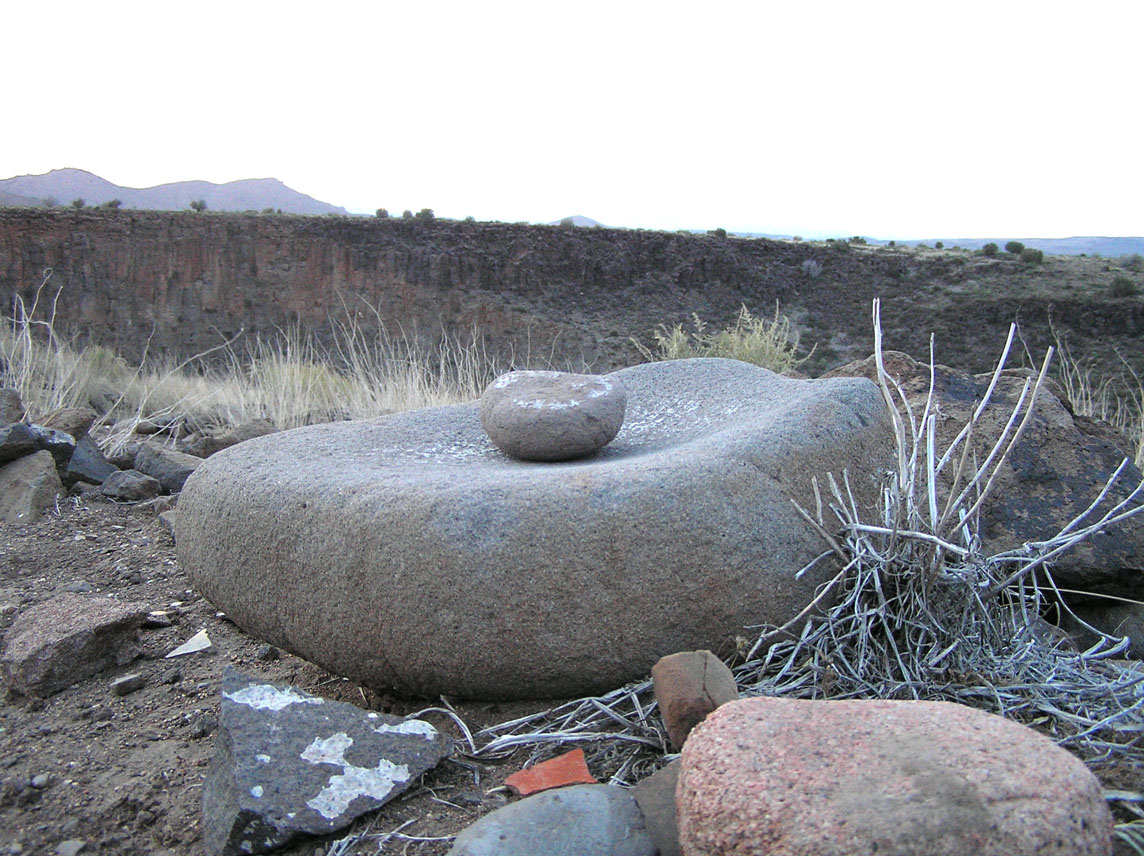
6. Mano and metate.
Jun 2007
7. A typical section of ground, covered in broken pottery.
Jun 2007
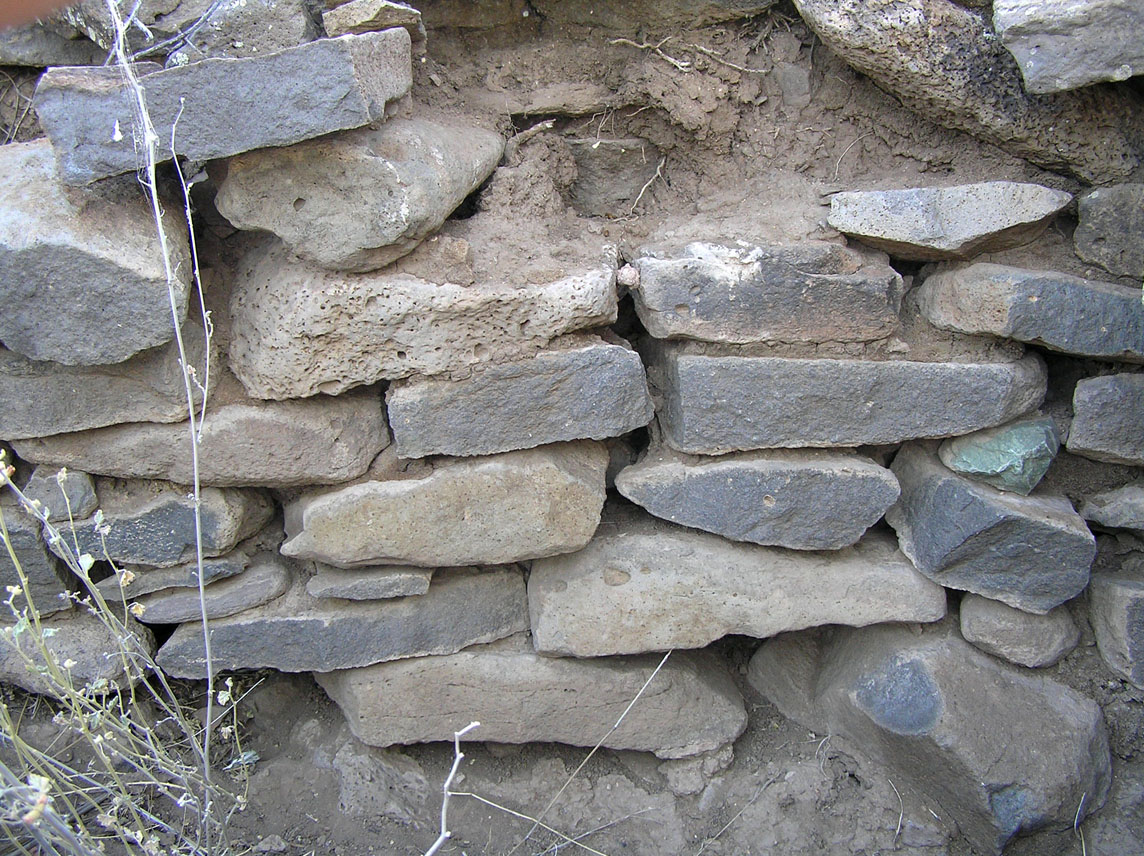
8. Section of wall showing remnants of mud mortar.
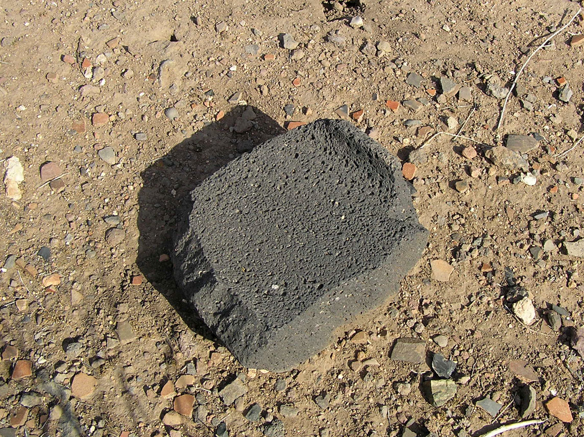
Photos 5 thru 7 show some of the artifacts found in the ruin. The metate in Photo 5 was used to grind maize (corn), nuts and seeds for food. The air pockets in the basalt from which it is made act like perpetually sharp sandpaper, which aids in the grinding. It also leaves grit in the food that is hard on the teeth. Another metate is shown in Photo 6.
Photo 7 shows the carpet of pot sherds that cover the site (compass included for scale). One of the interior walls is shown in Photo 8, with mud mortar still visible between the stones. This section will have been uncovered by looters, and once exposed to the elements will not long survive.